New map shows all the land managed by the hospital

Click image above to open as PDF.

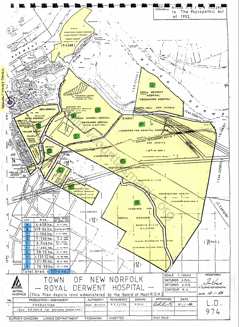
This 1988 colour coded map, shows how much land was owned and operated by the hospital. 333.6ha of land was managed by the administrators of the hospital, some land was farmed and the remaining either housing patients, staff or administration and support services for the hospital.

The hospital was ready for major expansion with all the land it managed, but due to the change of philosophy in care provision, the hospital started down sizing in the early to mid 1970’s.

The purple dot is the Derwent Valley Council Building in Circle Street which gives the viewer an idea of the scale of land under management.

Continue Reading

1947 Position Descriptions book

A wonderful read, especially the farm trade workers position description for 1947, the milkman not only had to deliver the fresh milk to the wards and kitchen, he was also responsible for milking the cows, only after cleaning their udders.

With the expansion of the hospital in the 1950 and 60s farming on the east side of the Lachlan River deceased although the Government land that once was Turriff Lodge had  fertile soils and provided many hours for work for patients. After the Turriff Lodge buildings were demolished the bricks were used for the foundation on the fowl sheds on the hospital farm. Will get a scan copy onto the documents tab soon.


Continue Reading