Click image above to open as PDF.
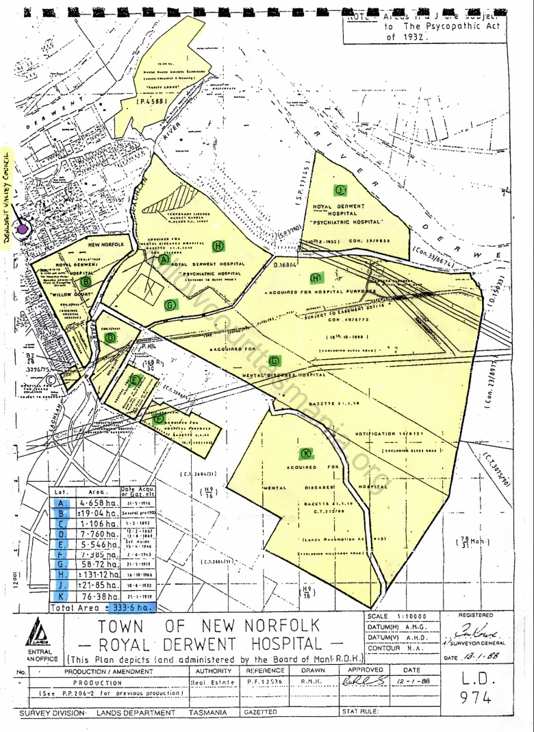
This 1988 colour coded map, shows how much land was owned and operated by the hospital. 333.6ha of land was managed by the administrators of the hospital, some land was farmed and the remaining either housing patients, staff or administration and support services for the hospital.
The hospital was ready for major expansion with all the land it managed, but due to the change of philosophy in care provision, the hospital started down sizing in the early to mid 1970’s.
The purple dot is the Derwent Valley Council Building in Circle Street which gives the viewer an idea of the scale of land under management.
3 Comments
Why can’t we have a map that shows both the Willow Court buildings and modern landmarks like Woolworths? It’s very hard navigate the old maps if I want to find the locality of specific buildings. For example, on the old maps I can’t pinpoint where would be the intersection of the the Avenue and George Street – at least that would give me a starting point. Do you have a map with both modern and old features?
Good point Michael, just need to time and I’ll do a google earth map.
Cheers
Mark
https://willowcourttasmania.org/documentation/maps/
Have you seen this page yet. There are a number of maps here that would assist in identifying the different stages or growth at the Asylum.
Cheers
Mark